高玉鉱山跡
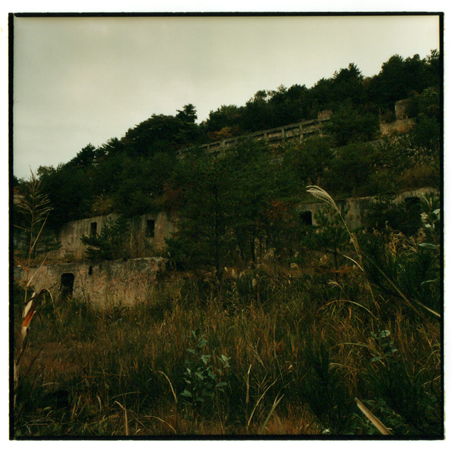
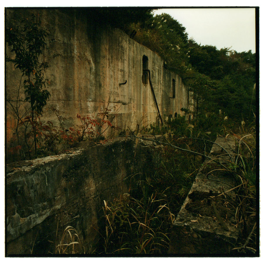
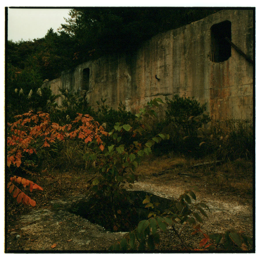
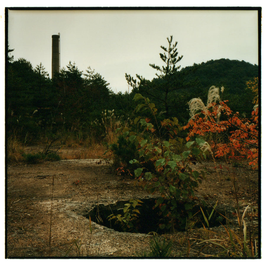
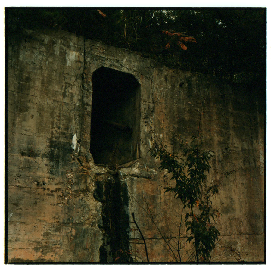
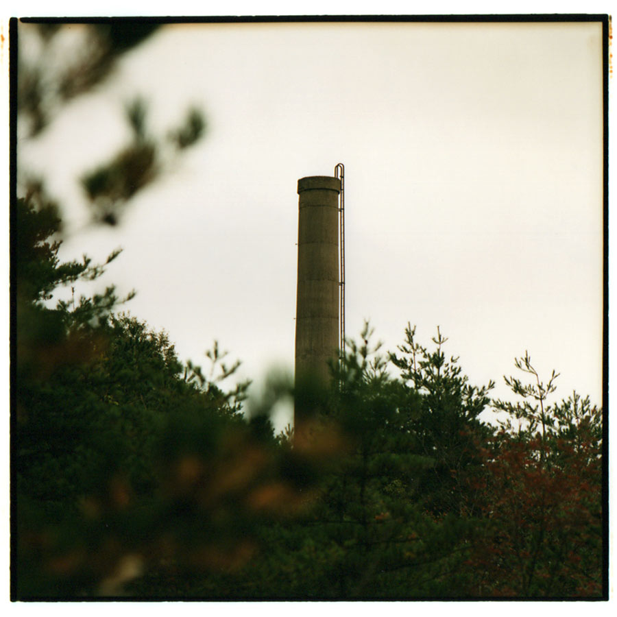
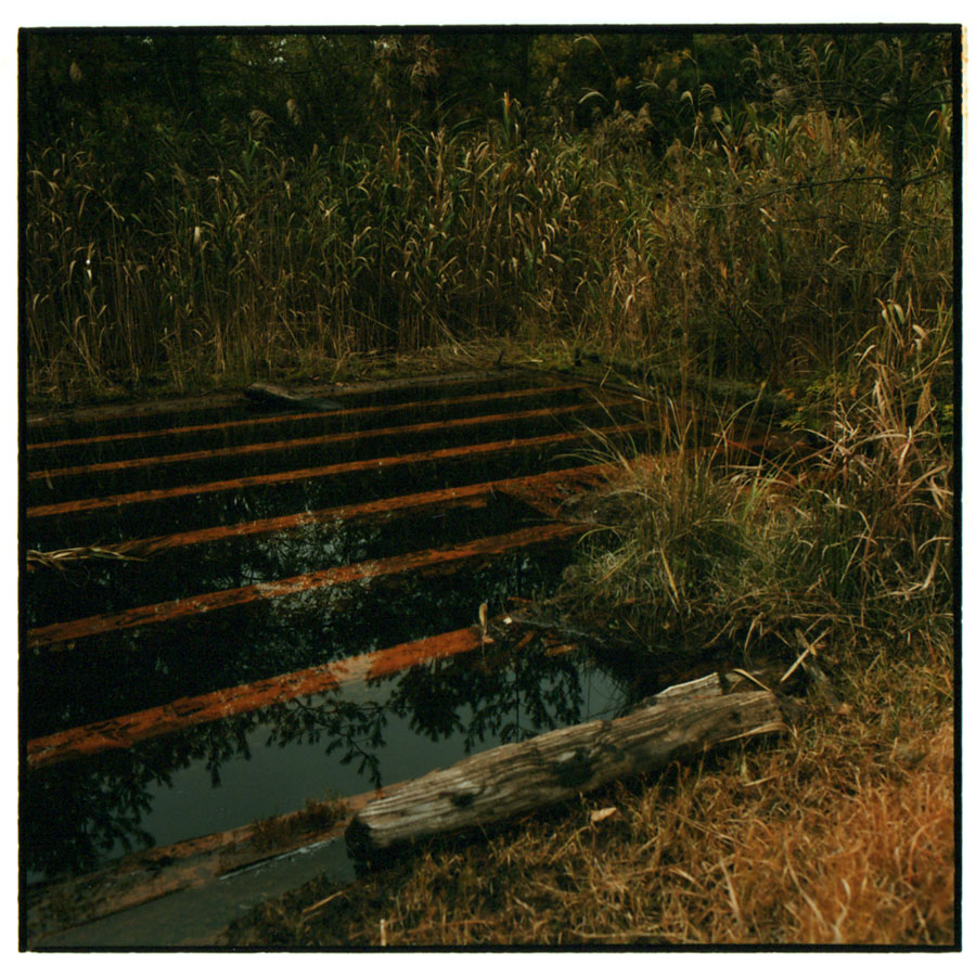
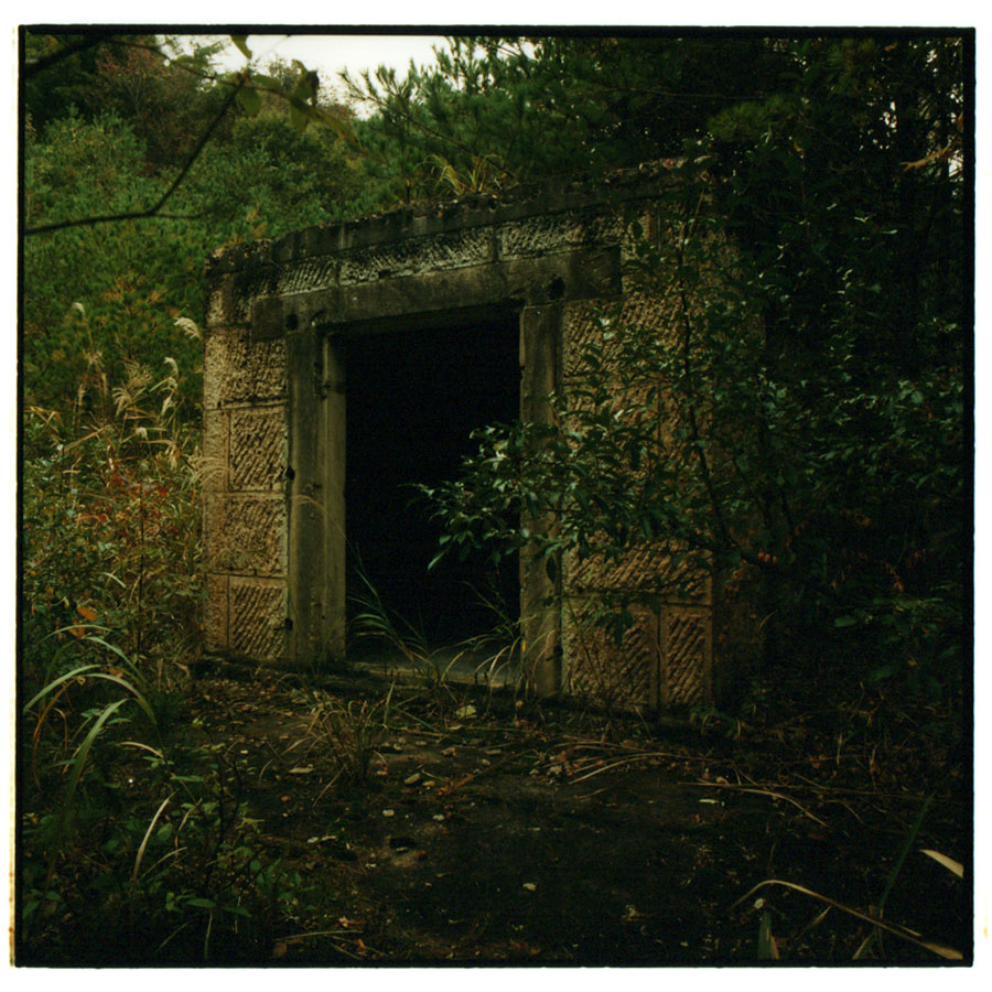
安土桃山期の初頭、1573 年(天正元年)の会津領主 蘆名盛興による開山が伝えられ、後の領主 蒲生氏郷が開発を引き継ぎます。 この時代、商工業の発展や軍備の拡張に伴う貨幣需要の増加から、各地の領主は金、銀、銅山の開発を奨励しました。 江戸期は二本松領最大の鉱山として金山奉行が置かれますが、鉱况は貞享年間から衰退に向かいます。 明治期に入ると政府は国内の鉱物を官有化して借区制を設け、鉱業を独占します。 1886 年(明治 19 年)に長崎の松浦健二は借区を受けて旧鉱滓を製錬し、旧坑を再開して探鉱を進めました。 次いで、1890 年(明治 23 年)に東京の実業家 肥田昭作らが事業を継承し、明治末期に日立製錬所への売鉱に転じました。 その後、1918 年(大正 7 年)の久原鉱業(後の日本鉱業)による鉱山買収を契機に、索道や製錬所の建設が進められ、高玉は近代化の道を歩むこととなります。 1939 年(昭和 14 年)には製錬所が増設され、最盛期の生産量は粗鉱 14 万 t、金 1 t、銀 10 t に上り、従業員数は 1,400 名に達して日本三大金山のひとつに名を連ねるまでに発展しました。 1943 年(昭和 18 年)に軍需政策として制定された金鉱業整備令を受けて製錬操業は休止を余儀なくされますが、含金珪酸鉱として採鉱と日立鉱山への送鉱が続けられます。 終戦後、製錬操業は 1952 年(昭和 27 年)から企業整備のために再び 3 年間の休止に至り、設備の一部は他へ転用されました。 その後、鉱業所は 1962 年(昭和 37 年)に高玉鉱山株式会社として新たに発足しますが、後に鉱量の枯渇を受けて閉鎖を迎えることとなります。 日本鉱業の経営下、生産総量は粗鉱 280 万 t、金 28 t、銀 280 t に上り、発見された鉱脈は 1,460 条、坑道の総延長は 600 km に及びました。 主要鉱床群のひとつである本山には昭和初期に建造された製錬所跡が今も残ります。
1976 年閉山
Takatama Mine
According to tradition, the gold mine was opened by Morioki Ashina, a feudal lord of the Aizu Domain, in 1573. Subsequently, Ujisato Gamo, later a feudal lord of the domain, took over the development. In this period, monetary demand increased due to the expansion of armaments in addition to the development of commerce and industry. Accordingly, the feudal lord of each domain promoted the development of gold, silver, and copper mines. In the 17th century, the mine was the largest in the Nihonmatsu Domain and was under the control of the Kinzan Bugyo, the magistrate of gold mines. However, production at the mine decreased from the 1680s. In the Meiji period, all of the minerals in the country were nationalized in order to collect tax and fees through granting leasehold rights, and the government monopolized the mining industry. Kenji Matsu-ura, from Nagasaki, acquired the rights in 1886 and resumed operations such as smelting of old slag and exploration. Afterwards, Shosaku Hida, a businessman from Tokyo, and others took over the operations in 1890 and sold mined ore to Hitachi Smelter from the early 20th century. In 1918, Kuhara Mining Co., Ltd., later Nippon Mining Co., Ltd., acquired the mine, leading to modernization, such as the construction of aerial tramways and a cyanide plant, to the mine. After the expansion of the plant in 1939, the mine reached its peak. At the time, the mine employed 1,400 people and produced 140,000 tonnes of crude ore, one tonne of gold, and 10 tonnes of silver per year. As a result, the mine ranked as one of Japan's three largest gold mines. Although the formulation of the Policy on the Arrangement of the Gold Mining Industry caused suspension of the smelting operations in 1943, mined ore was sent to Hitachi Mine as gold-bearing silicate ore. After the war, smelting operations were suspended again for three years as part of operational streamlining in 1962, and part of its equipment was diverted to other uses. The company separated Takatama Mining Works and transferred the management of the mine to newly formed Takatama Mining Co., Ltd. in 1962. However, the mine was closed due to depletion of reserves later. Under the management of Nippon Mining Co., Ltd., the mine produced over 2.80 million tonnes of crude ore, 28 tonnes of gold, and 280 tonnes of silver. The number of discovered ore veins was 1,460, and the mine tunnels had a total length of 600 kilometers. The remains of the plant, built in the first half of the 20th century, can still be found today at Honzan.
closure in 1976
福島県郡山市熱海町高玉
金、銀
Takatama, Atami Town, Koriyama City, Fukushima
gold, silver
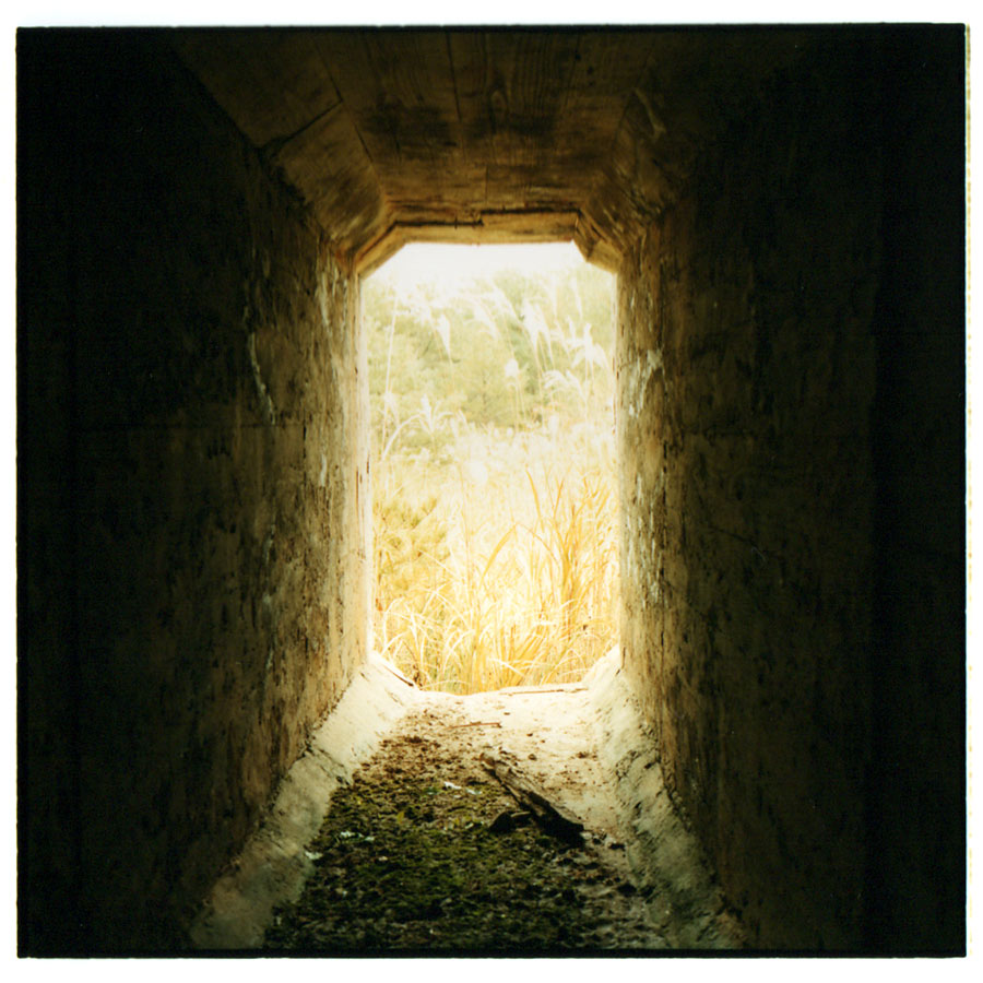
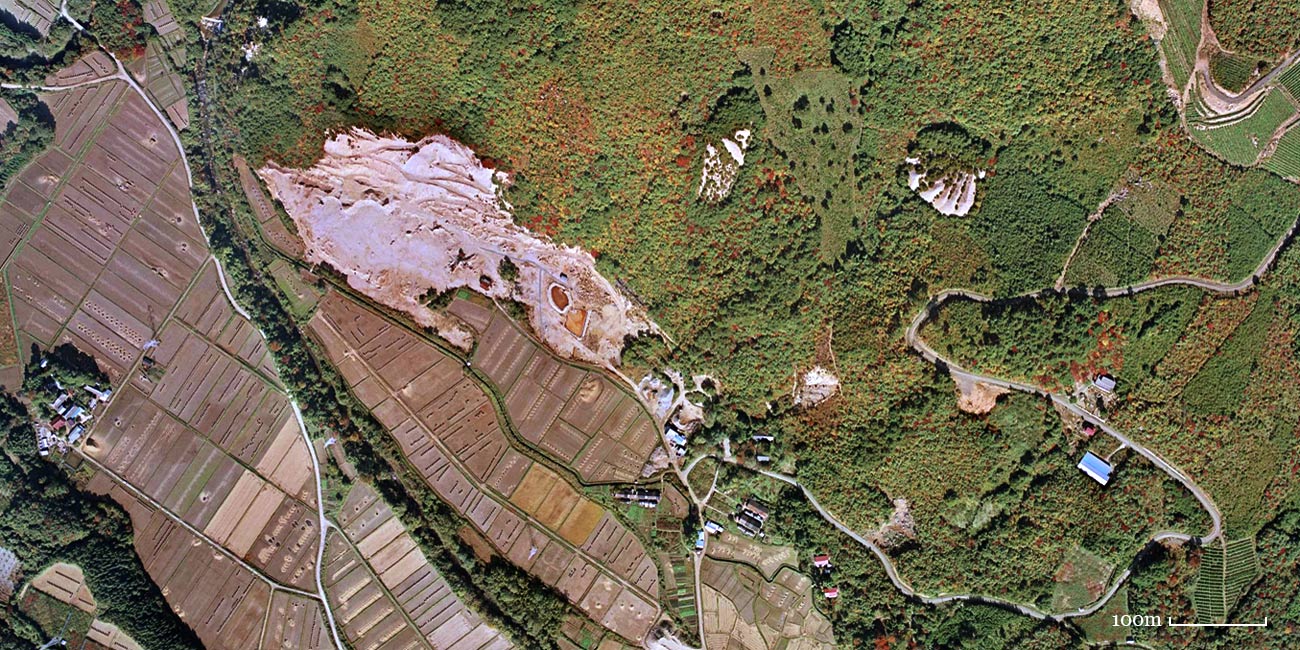
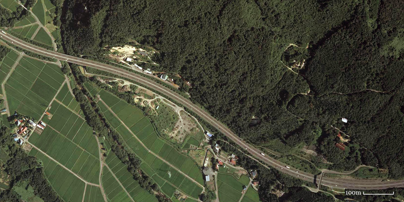
鉱床は北から鶯、本山、青木葉の 3 鉱床群が並び、中核をなす本山と麓に位置する磐越西線熱海駅(後の磐梯熱海駅)との間には約 5 km にわたって索道が架設されました。 600 条ほどの鉱脈が集中する本山には 1935 年(昭和 10 年)建造の青化製錬所をはじめ、選鉱場や鉱山事務所などが築かれました。 また本山、青木葉の両地区では町や集落が形成され、鉱員住宅が並んで賑わいを見せました。
The mine had three groups of ore deposits, namely, Uguisu, Honzan, and Aokiba, and they extended from the north. An aerial tramway with a length of five kilometers connected Honzan to Atami Station, later Bandai-Atami Station, on the Ban-Etsu West Line. Honzan had approximately 600 ore veins and mining facilities, such as a cyanide plant built in 1935, a beneficiation plant, and a mining office. In mining settlements formed at Honzan and Aokiba, numerous miners' row houses were lined up for employees and their families.
本山地区
Honzan area
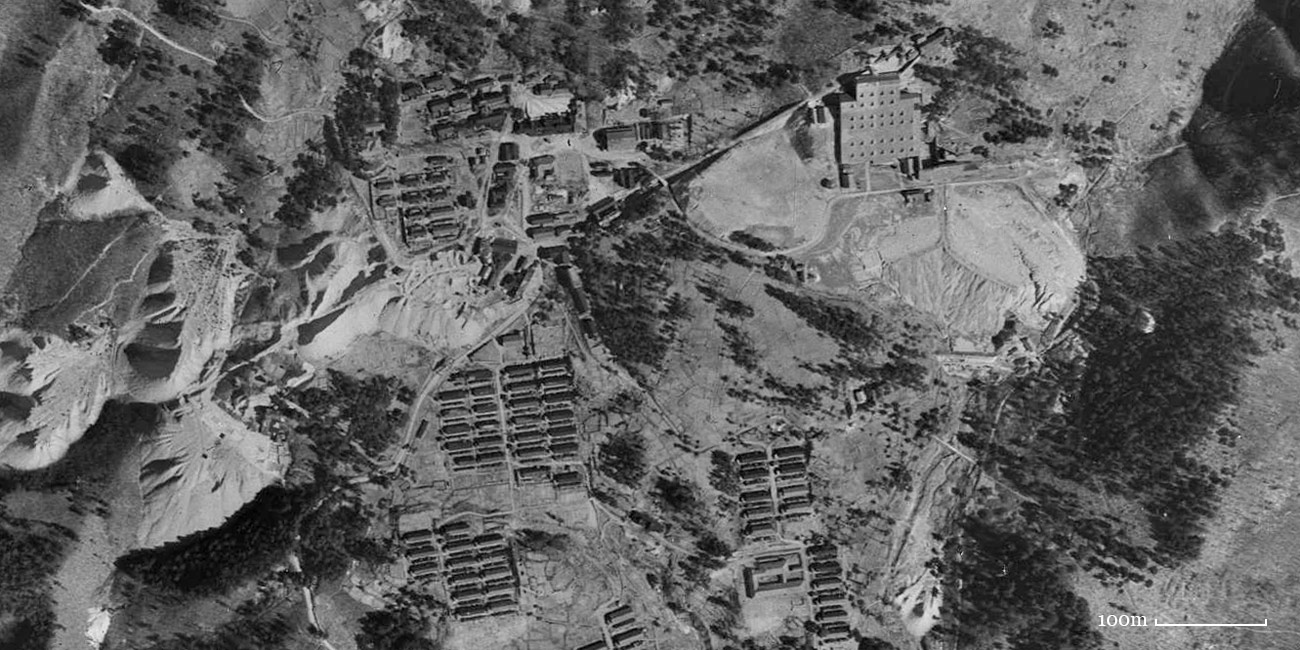
© 国土地理院
At the time of 1948
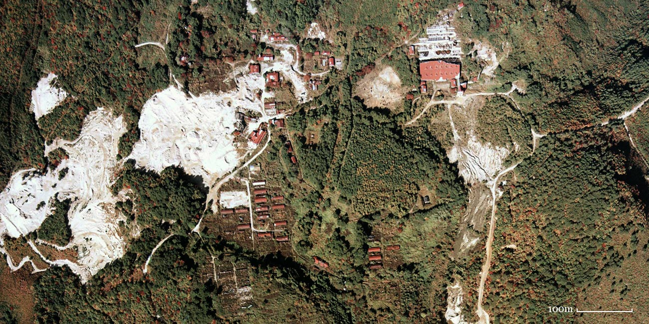
© 国土地理院
At the time of 1975
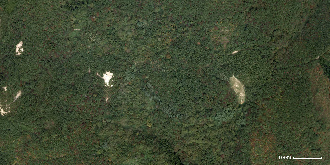
© 国土地理院
At the time of 2011
青木葉地区
Aokiba area

© 国土地理院
At the time of 1948
© 国土地理院
At the time of 1975
© 国土地理院
At the time of 2007